Search all categories
Animals & Pet Supplies
Arts & Entertainment
Baby & Toddler
Business & Industrial
Cameras & Optics
Clothing & Accessories
Electronics
Food, Beverages & Tobacco
Furniture
Hardware
Health & Beauty
Home & Garden
Luggage & Bags
Mature
Media
Office Supplies
Software
Sporting Goods
Toys & Games
Vehicles & Parts
All categories
Kaicus
Animals & Pet Supplies
Arts & Entertainment
Baby & Toddler
Business & Industrial
Cameras & Optics
Clothing & Accessories
Electronics
Food, Beverages & Tobacco
Furniture
Hardware
Health & Beauty
Home & Garden
Luggage & Bags
Mature
Media
Office Supplies
Software
Sporting Goods
Toys & Games
Vehicles & Parts
Deals
Store List
Brands
Blog
Deals
Categories
Animals & Pet Supplies
Arts & Entertainment
Baby & Toddler
Business & Industrial
Cameras & Optics
Clothing & Accessories
Electronics
Food, Beverages & Tobacco
Furniture
Hardware
Health & Beauty
Home & Garden
Luggage & Bags
Mature
Media
Office Supplies
Software
Sporting Goods
Toys & Games
Vehicles & Parts
Information
About us
Privacy Policy
Terms and Conditions
Contact
FAQs
Tips for buyers
© 2026,
Kaicus
- Smart Shopping
All rights reserved
Kaicus
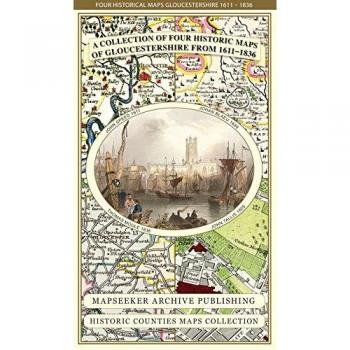
Gloucestershire 1611 - 1836 - Fold Up Map that features a collection of Four Historic Maps, John Speed's County Map 1611, Johan Blaeu's County Map of 1648, Thomas Moules County Map of 1836 and a Plan
Gloucestershire 1611 - 1836 - Fold Up Map that features a collection of Four Historic Maps, John Speed's County Map 1611, Johan Blaeu's County Map of 1648, Thomas Moules County Map of 1836 and a Plan
19.99 GBP
Brand
:
Historical Images Ltd
Deals
Characteristics
Sponsored
This site contains affiliate links for which we may receive compensation.
More information
Sponsored
Gloucestershire 1611 - 1836 - Fold Up Map that features a collection of Four Historic Maps, John Speed's County Map 1611, Johan Blaeu's County Map of 1648, Thomas Moules County Map of 1836 and a Plan
WHSmith
19.99 GBP
19.99 GBP
21-04-2026 18:10:05
Access to the deal
Related products
Branch Lines Of Gloucestershire
0.00
View Product
Lost Railways of Gloucestershire
11.99 GBP
View Product
Gloucestershire Airfields in the Second World War by David Berryman (English) Pa
0.00 GBP
View Product
Brewing in Gloucestershire
17.98 GBP
View Product